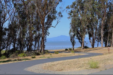
The view upon crossing a bridge into Point Pinole is just the beginning of some great sights to come.
Photo essay, Joe Porrello
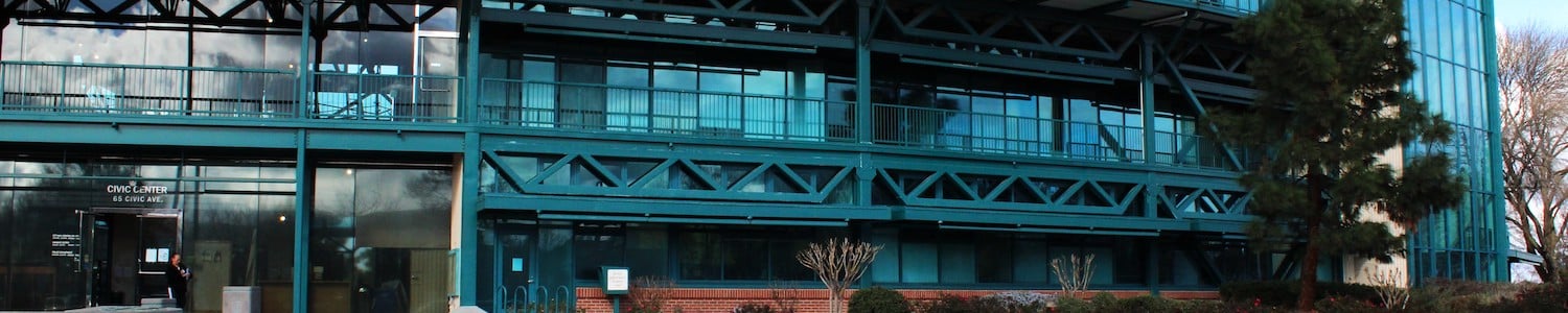
West Contra Costa County features some of the East Bay’s best hiking trails — four of which are free on weekdays, with shaded paths, picnic areas, dogs allowed, ample parking, great views, weather that’s often ideal with refreshing breezes (and hardly any mosquitoes).
Despite all the benefits, there are regularly very few people walking along the beautiful paths in wildlife areas that were once home to different Native American tribes and are now operated by the East Bay Regional Park District.
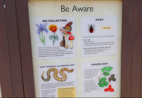
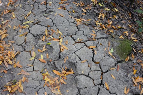
As in any similar landscape, perhaps potential hikers are deterred by the possibility of rattlesnakes, ticks, poison oak, mountain lions, coyotes and bobcats, as well as steep and narrow paths. Additionally, trails so dry that they crack during the summer become so muddy they’re almost unwalkable in winter.
Yes, as warning signs like these at each trailhead show, hiking comes with some risks. But you can take care to avoid some problems. And these West Contra Costa trails are well worth it.
Long stretches without rain leave trails looking desperate for a drink. When the rains do come, they can leave these same trails too muddy to walk on.
Nevertheless, each of the four trails below has unique traits making them worth a visit.
Sobrante Ridge
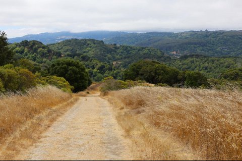
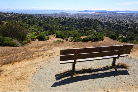
The views at Sobrante Ridge leave one wondering why there aren’t more people around.
Sobrante Ridge Botanic Regional Preserve is the least frequented of these four hiking areas. While a small parking lot at the end of Coach Drive in Richmond is considered the main entrance, the park is also accessible through multiple different neighborhood trailheads.
Its lack of visitors may stem from being the only trail on this list without a restroom or water station, but the serenity alone is worth it. It’s also the only one with free parking on weekends and holidays from April through October.
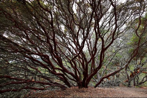
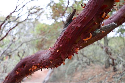
Not to mention, Sobrante Ridge is one of only two sites in the world where the Alameda Manzanita grows. The rare tree’s burgundy bark reveals a neon orange color underneath when it peels — a sight to behold. In the spring, it blossoms with flowers.
The rare Alameda Manzanita tree’s narrow branches sprawl outward like a nervous system.
The Alameda Manzanita tree has cartoon-like colors while it sheds its bark.
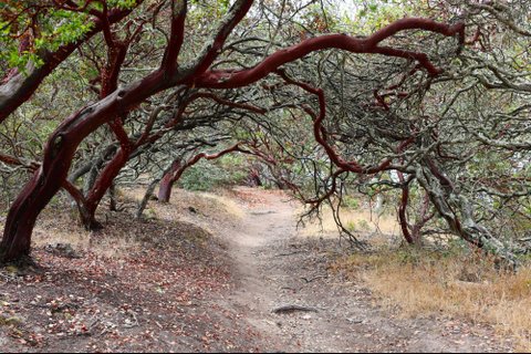
Alameda Manzanita trees create a tunnel of sorts on the eponymous Manzanita Trail.
Although there are only small stretches of flatground and trails can be slightly strenuous, picnic tables scattered strategically placed throughout provide opportunities to catch a quick break — and a great view.
The tan summer hills in Sobrante Ridge will likely become green by winter.
Dedicated to the EBRPD by a construction company in 1985 after developers agreed to preserve the scenic ridgelands, Sobrante Ridge opened to the public three years later.
Originally, the site was an ancestral homeland of the Saclan, one of six California Native tribes whose primary language is called Bay Miwok today. Decades later, the site became known as Cutter Ranch in the 1970s when it was owned by Berkeley-based Cutter Laboratories — which developed vaccines for tetanus and diphtheria through testing on horses and cattle raised there. Now tranquil wilderness, the area was once known for dirtbiking and loud partying.
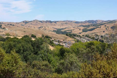
A housing development sits nestled into the ridgelands of El Sobrante.
Open every day from 5 a.m. to 10 p.m., the 277-acre park and its four paths — covering a little over four miles — offers seemingly endless rolling hills and views of Mt. Diablo, along with both sun and shade. It stretches from the Pinole Valley Dog Park all the way to our next park, Kennedy Grove.
Kennedy Grove
Hiking in Kennedy Grove can feel like walking through a fairy tale.
Kennedy Grove Regional Recreation Area also features four paths of roughly four miles in total with even sun and shade that take about two hours to complete altogether.
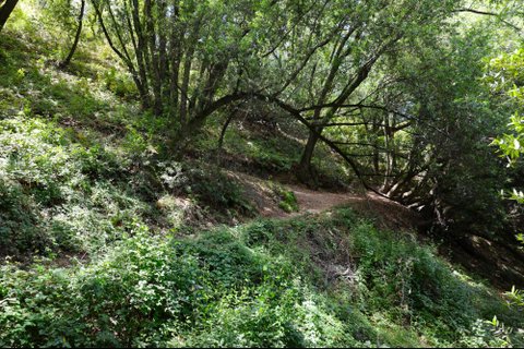
Each unpaved path has very rough, steep and narrow sections, other than the moderate Laurel Loop Trail. On the bright side, the way back is all downhill and often has refreshing winds.
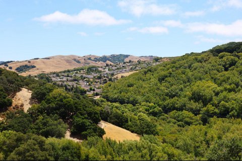
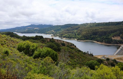
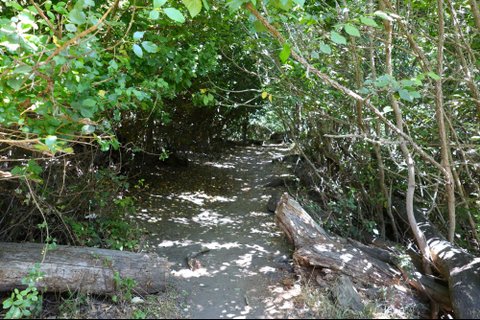
The 222-acre park has views of San Pablo Dam and rolling hills. Visitors can hear whispering eucalyptus trees and critters like salamanders scattering off paths over dry leaves when they hear footsteps approaching.
San Pablo Dam can be seen without obstruction from the Upper Seafoam Trail at Kennedy Grove.
Kennedy Grove’s base features a vast grassy meadow surrounded by tall trees and a paved walkway, two areas with a number of picnic tables and grills, a volleyball court, restrooms and ADA-approved water stations.
Dedicated to and named after John F. Kennedy in 1967 following his assassination, the site used to be home to ranchos and wheat fields, along with stations for a narrow gauge railroad that ran from Oakland to Orinda through Richmond and the El Sobrante hills.
The park opens every day at 8 a.m. and closes between 5:30-8 p.m. depending on the month. Parking is free except on weekends and holidays from April through September, when the fee is $5.
Alvarado Park
Some hills at Alvarado Park are a great workout — with the payoff of great views.
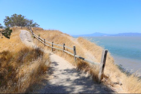
A 42-acre section at the northern tip of the 2,789-acre Wildcat Canyon, Alvarado Park sits on the opposite side of San Pablo Dam from Kennedy Grove and has trails that run all the way to Berkeley’s Tilden area.
Visitors should be prepared to brush up with wilderness at Alvarado Park.
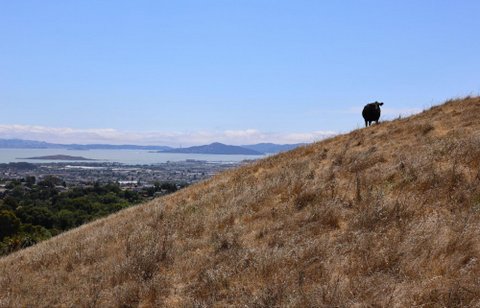
With numerous interconnected paths and entrances in many neighborhoods, it offers the chance for changes of scenery depending on which trail one takes. Lots of slight climbs pay off with unique sights of the bay and even up close and personal encounters with grazing cattle.
Views at Alvarado Park are one-of-a-kind and can be accessed with relative ease from higher entry points.
Even the grazing cattle at Alvarado Park can soak in the sights.
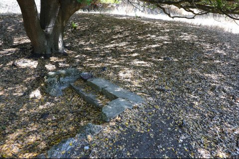
One highlight of Alvarado Park’s paths is the remnants of a two-story mansion. It was used as a sanitarium until the 1960s when it was abandoned. Then, in 1977, it was burned down by vandals. Now, all that remains is a small portion of concrete wall, a two-step staircase and palm trees planted to adorn what was once a front lawn. According to a sign at the park, it was where Bay Area elites sent their family members with mental illness; locals were told to stay away.
These steps at Alvarado Park are one of the last remnants of a sanitarium from decades ago.
Though. originally, Wildcat Canyon in its entirety was the homeland of the Huchiun, an Ohlone tribe whose members spoke the Karkin language and thrived there for generations.
The area had a 220-foot winding slide during the early 1900s, and in Prohibition times was home to a speakeasy, the Chateau Cafe. The park is named for Juan Bautista Alvarado who was governor of Alta California before the region entered the union. It became part of Wildcat Canyon in 1985 when it was transferred to EBRPD from the city of Richmond.
Relatively busy on mornings and weekends, Alvarado Park is always free and is open 5 a.m.-10 p.m. The main parking lot opens at 7:30 a.m. and closes between 5-7 p.m. depending on the time of year.
Point Pinole
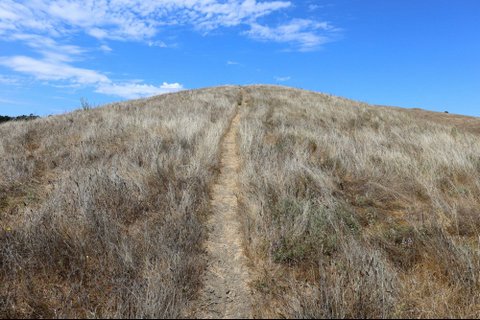
Point Pinole trails have only short inclines, making for a leisurely stroll.
Designated as a state landmark with 2,432 acres and over 12 miles of intertwining trails, Point Pinole Regional Shoreline is the flattest and overall easiest to hike of the four areas.
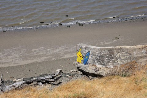
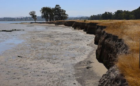
The interconnected paths have abundant shade, multiple restrooms and water fountains with attached dog bowls, views of marshes and up close sights of San Pablo Bay, accessible beaches and bay breezes.
The beaches at Point Pinole are great for dogs; just prepare for windy conditions.
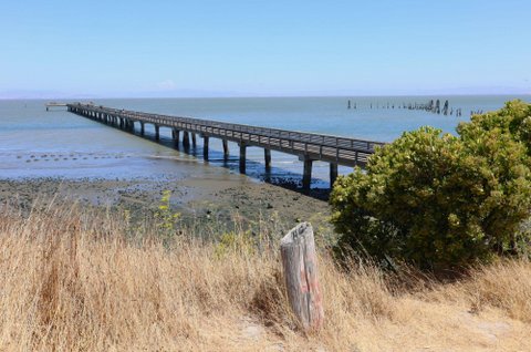
Visitors can also stand on a bridge waiting for trains to pass beneath them, go fishing on a 1,250-foot pier, look at bunches of shedding eucalyptus trees, or read from the many information tables placed throughout.
A fishing pier at Point Pinole usually has more people on it than the trails to get there.
Some of the information tables allude to why there are so many eucalyptus trees. Now, they are seen as an invasive species, though they do provide shelter for wildlife like deer, owls, monarch butterflies and over 100 species of birds. The trees were initially planted as protection against possible explosions from one of four companies manufacturing dynamite and gunpowder there from 1881-1960.
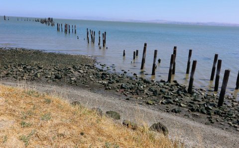
Remnants of said industry are seen in a black powder press, multiple bunkers and the skeleton of an old wharf that once bustled with business from employees of the companies. Tracks used to haul explosives from the area were later purchased by Walt Disney and shipped to Anaheim to become part of the Disneyland railroad.
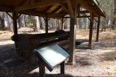
A black powder press at Point Pinole serves as a reminder of the dynamite companies that once operated there.
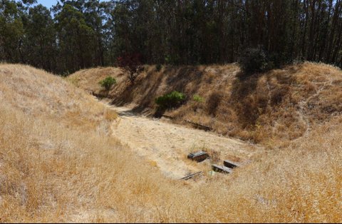
One of three bunkers at Point Pinole used to test dynamite for decades.
The remains of an old wharf at Point Pinole that once was filled with businesses.
Long before that, the Huchiun tribe called it home for decades and flourished there along with the land. After California gained statehood in 1850, the area was home to Chinese and Croatian fishing villages. It opened to the public in 1973 after a long process of acquisition of EBRPD from Bethlehem Steel.
The point is open 8 a.m. through 4-7 p.m. depending on the month. Parking is free except on weekends and holidays between April and October.
Point Pinole has so many paths, one might miss a great view if they are not careful.
Friendly Reminder
Always remember to respect the land and wildlife. Anything you bring into the park and any trash you create should come out with you or be properly disposed of. And don’t forget to bring enough water to stay hydrated. Adventure awaits.
We Belong Outdoors: Bay Area Groups Confront… The Bay Area's great outdoors often mirrors its difficult history of systemic inequality, revealing who gets access to nature and who doesn't.
Learning from the Past: SFPD Officers Gain New… Through the Sojourn Project, SFPD officers meet people connected to the civil rights movement to learn how that history relates to policing today.
Organizers of Training on Missing and Murdered… Native organizers are working to educate California law enforcement about the Missing and Murdered Indigenous Persons crisis and resources to address it.
Thank you so much for highlighting these natural treasures right here in our neighborhood! I love all four of the parks you reviewed and hike in them often. Each season has its special flavor. Mother nature offers us such an abundance of life and beauty, there for the taking. Do your body, mind, and spirit a favor–get out and enjoy these spaces!!
Post A Comment
Enjoy our content? SIGN UP FOR OUR NEWSLETTER
We use cookies on our website to give you the most relevant experience by remembering your preferences and repeat visits. By clicking “Accept”, you consent to the use of ALL the cookies.
This website uses cookies to improve your experience while you navigate through the website. Out of these, the cookies that are categorized as necessary are stored on your browser as they are essential for the working of basic functionalities of the website. We also use third-party cookies that help us analyze and understand how you use this website. These cookies will be stored in your browser only with your consent. You also have the option to opt-out of these cookies. But opting out of some of these cookies may affect your browsing experience.
Necessary cookies are absolutely essential for the website to function properly. These cookies ensure basic functionalities and security features of the website, anonymously.
Cookie
Duration
Description
cookielawinfo-checbox-analytics
11 months
This cookie is set by GDPR Cookie Consent plugin. The cookie is used to store the user consent for the cookies in the category "Analytics".
cookielawinfo-checbox-functional
11 months
The cookie is set by GDPR cookie consent to record the user consent for the cookies in the category "Functional".
cookielawinfo-checbox-others
11 months
This cookie is set by GDPR Cookie Consent plugin. The cookie is used to store the user consent for the cookies in the category "Other.
cookielawinfo-checkbox-necessary
11 months
This cookie is set by GDPR Cookie Consent plugin. The cookies is used to store the user consent for the cookies in the category "Necessary".
cookielawinfo-checkbox-performance
11 months
This cookie is set by GDPR Cookie Consent plugin. The cookie is used to store the user consent for the cookies in the category "Performance".
viewed_cookie_policy
11 months
The cookie is set by the GDPR Cookie Consent plugin and is used to store whether or not user has consented to the use of cookies. It does not store any personal data.
Functional cookies help to perform certain functionalities like sharing the content of the website on social media platforms, collect feedbacks, and other third-party features.
Performance cookies are used to understand and analyze the key performance indexes of the website which helps in delivering a better user experience for the visitors.
Analytical cookies are used to understand how visitors interact with the website. These cookies help provide information on metrics the number of visitors, bounce rate, traffic source, etc.
Advertisement cookies are used to provide visitors with relevant ads and marketing campaigns. These cookies track visitors across websites and collect information to provide customized ads.


Marilyn Langlois
Posted at 18:07h, 08 AugustThank you so much for highlighting these natural treasures right here in our neighborhood! I love all four of the parks you reviewed and hike in them often. Each season has its special flavor. Mother nature offers us such an abundance of life and beauty, there for the taking. Do your body, mind, and spirit a favor–get out and enjoy these spaces!!